DEN’s 50 Year Vision
In collaboration with CH2M HILL, Tryba Architects developed a visionary 50-year plan for DEN’s aviation and regional development. As one of the world’s leading airports and the region’s largest economic engine, DEN spans 53 square miles, boasting 12 runways and 9,000 acres of prime, developable land. To anchor the project’s ambitious goals and deliver a clear, compelling vision, graphic design played a pivotal role. Through thoughtful design elements, complex site dynamics, natural resource planning, and economic opportunities were translated into visually intuitive formats, making the vision accessible and easy to understand. This approach allowed stakeholders to grasp the intricacies of DEN’s transformation, while reinforcing its future as a premier multi-modal hub and global center for travel, commerce, innovation, and culture.
ALL IMAGES AND DIAGRAMS ARE PROPERTY OF TRYBA ARCHITECTS AND ARE BEING SHOWN FOR PORTFOLIO PURPOSES ONLY.-
Tryba Architects
Adriel Heisey - Photography
-
DEN - 50 Year Master Plan Document
Marketing Materials
Stakeholder Presentations
Diagrams and Site Plans
Connect to the Region
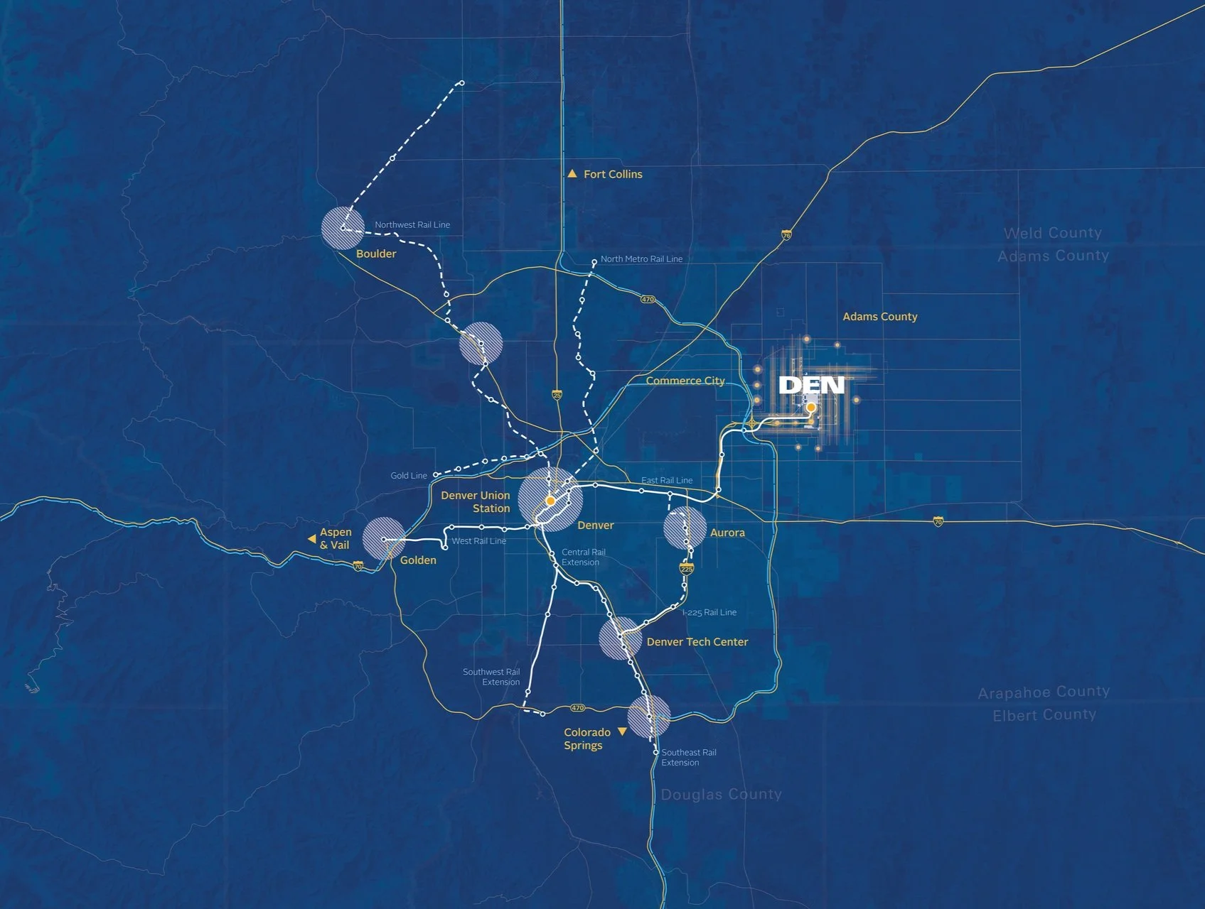
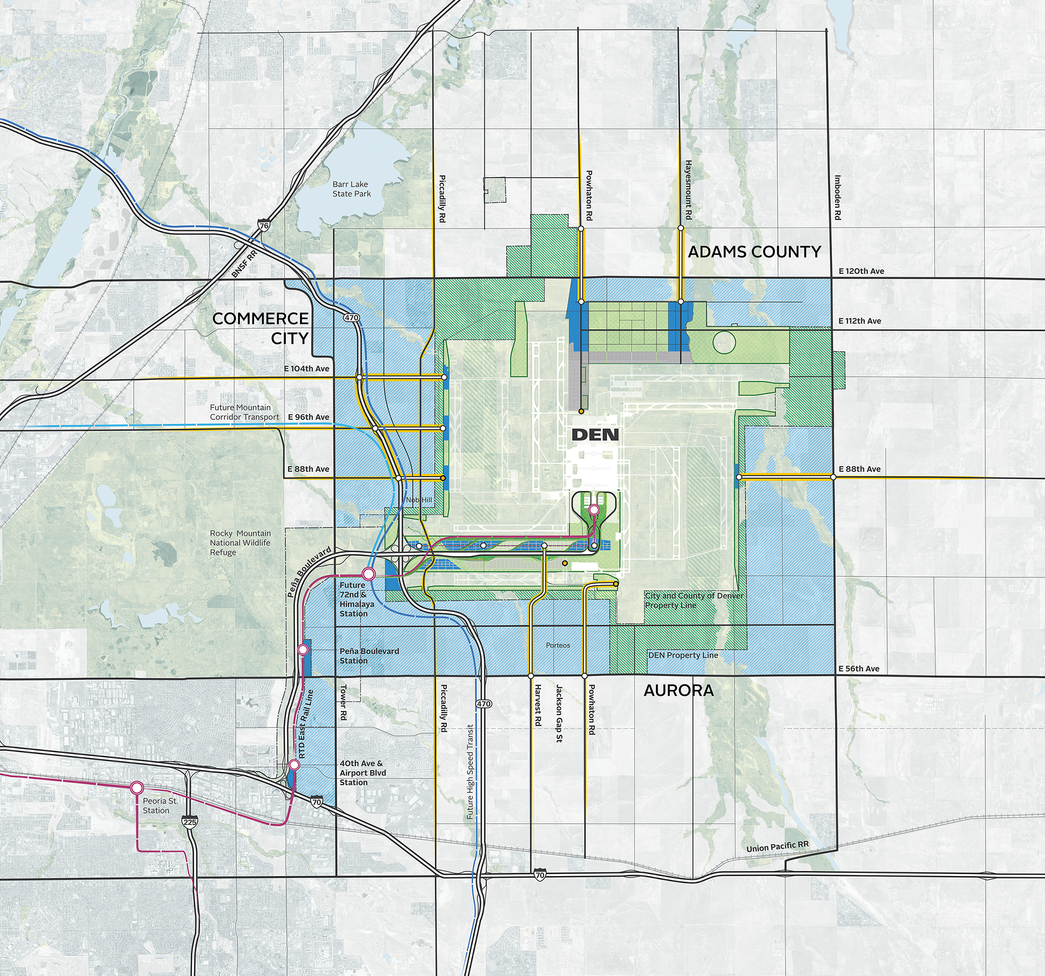
This project seamlessly integrates the rich history of the airport with its forward-looking vision, narrating the transformation of both the facility and the rapidly expanding region. The diagram below illustrates key connections, showcasing the extension and adaptation of the RTD network to meet growing demand, future runway expansions that bolster the airport’s capacity, and the continued development of the Peña Boulevard corridor as a vital commercial and transportation hub. Additionally, the plan emphasizes the role of the region's agricultural heartland, its integration into the broader economy, and the preservation of open spaces and trail networks, ensuring sustainable growth while enhancing recreational and environmental assets. This holistic approach underscores the airport’s role as a catalyst for regional development, positioning it at the intersection of mobility, economic growth, and environmental stewardship.
Peña Boulevard
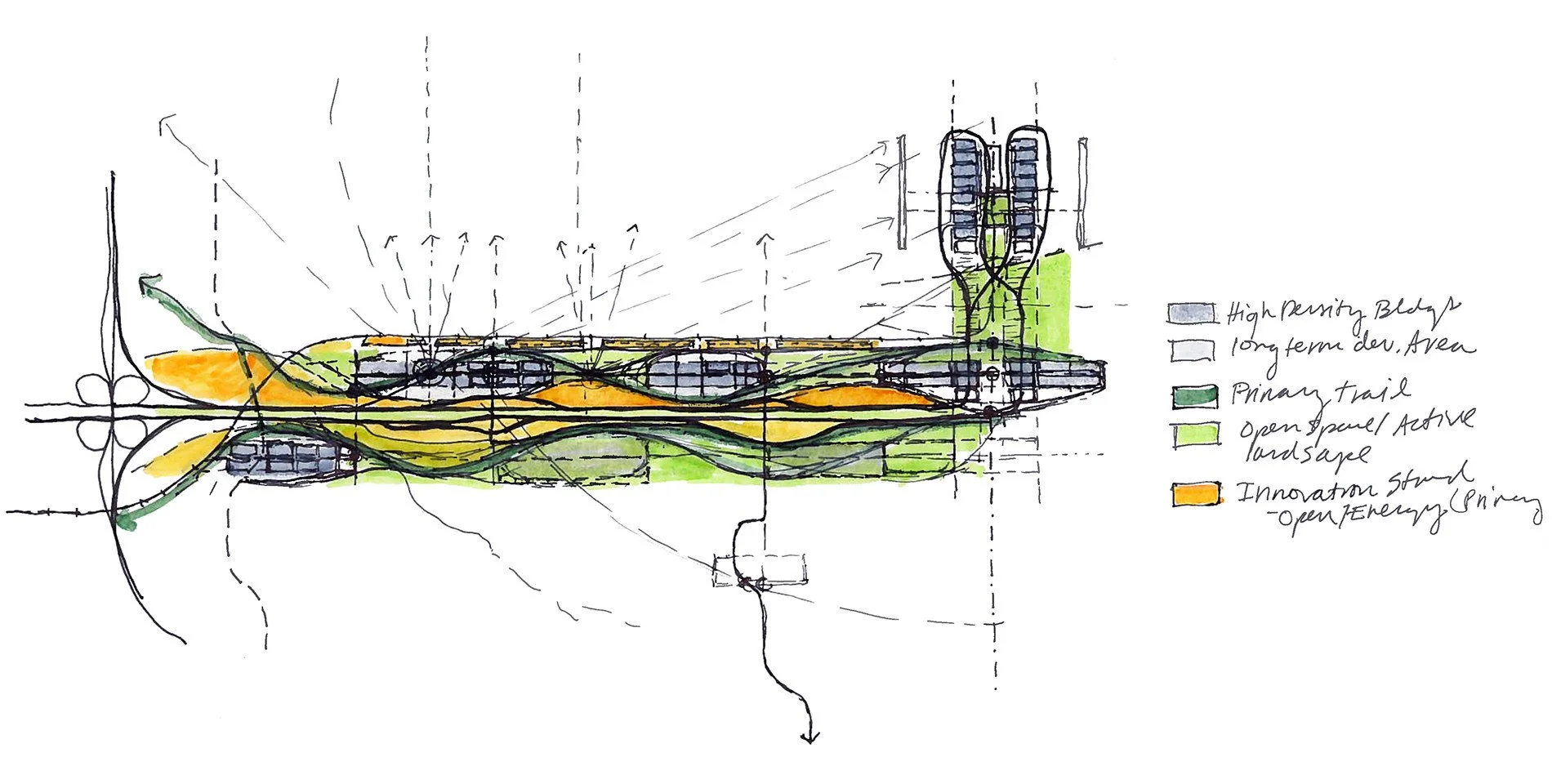
The hand-drawn sketch above by urban designer Kathleen Fogler illustrating future plans for Peña Boulevard, highlighting the integration of preserved open spaces and a thoughtfully designed trail network that weaves through the development, promoting accessibility and sustainability. Kathleen’s sketches would serve as the inspiration for graphic interpretations of the concepts.
Whole Site Design
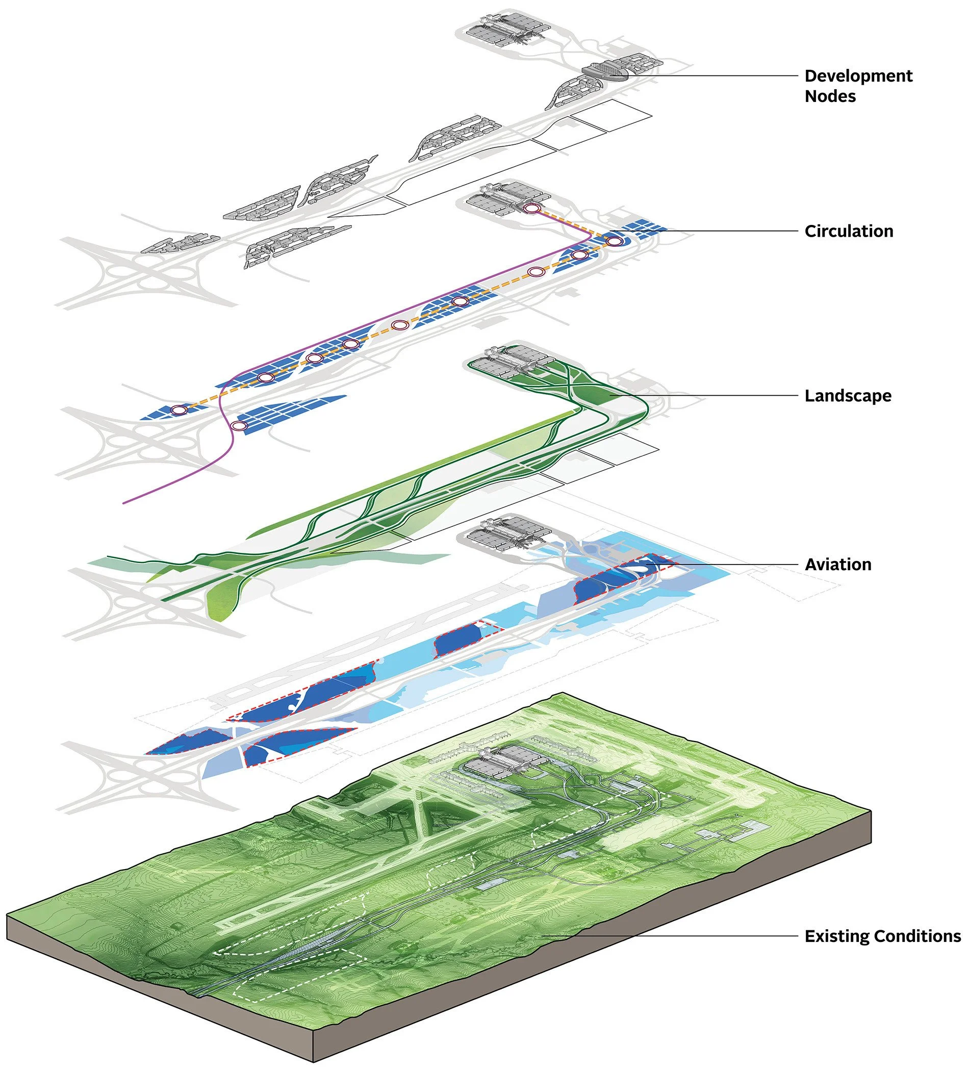
Visualizing the layers of analysis in an urban design project is crucial for uncovering insights and connections that shape effective, holistic solutions. It transforms complex data into actionable design strategies, ensuring that every layer of the urban fabric is thoughtfully considered and integrated.
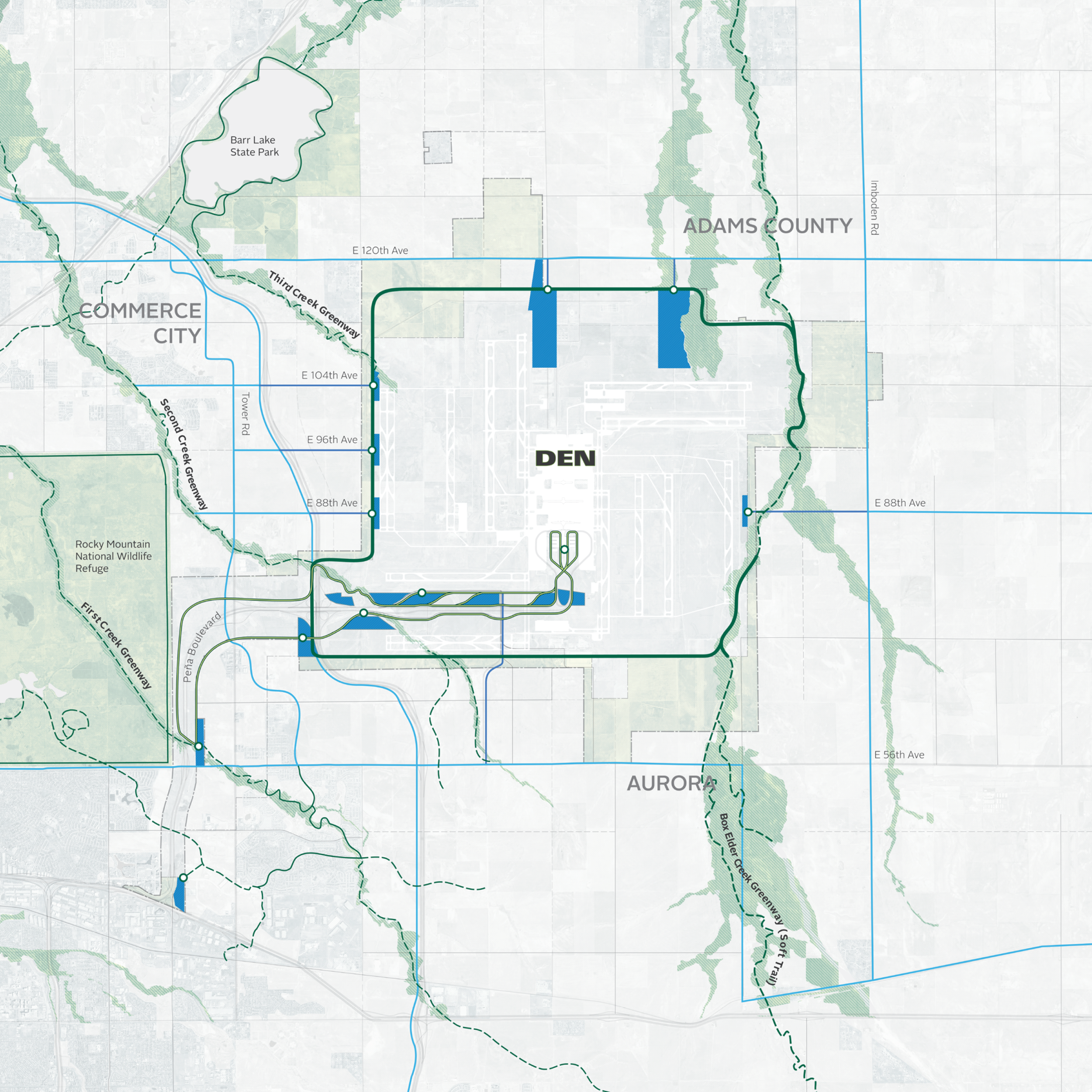
GREENSPACE + TRAIL NETWORK
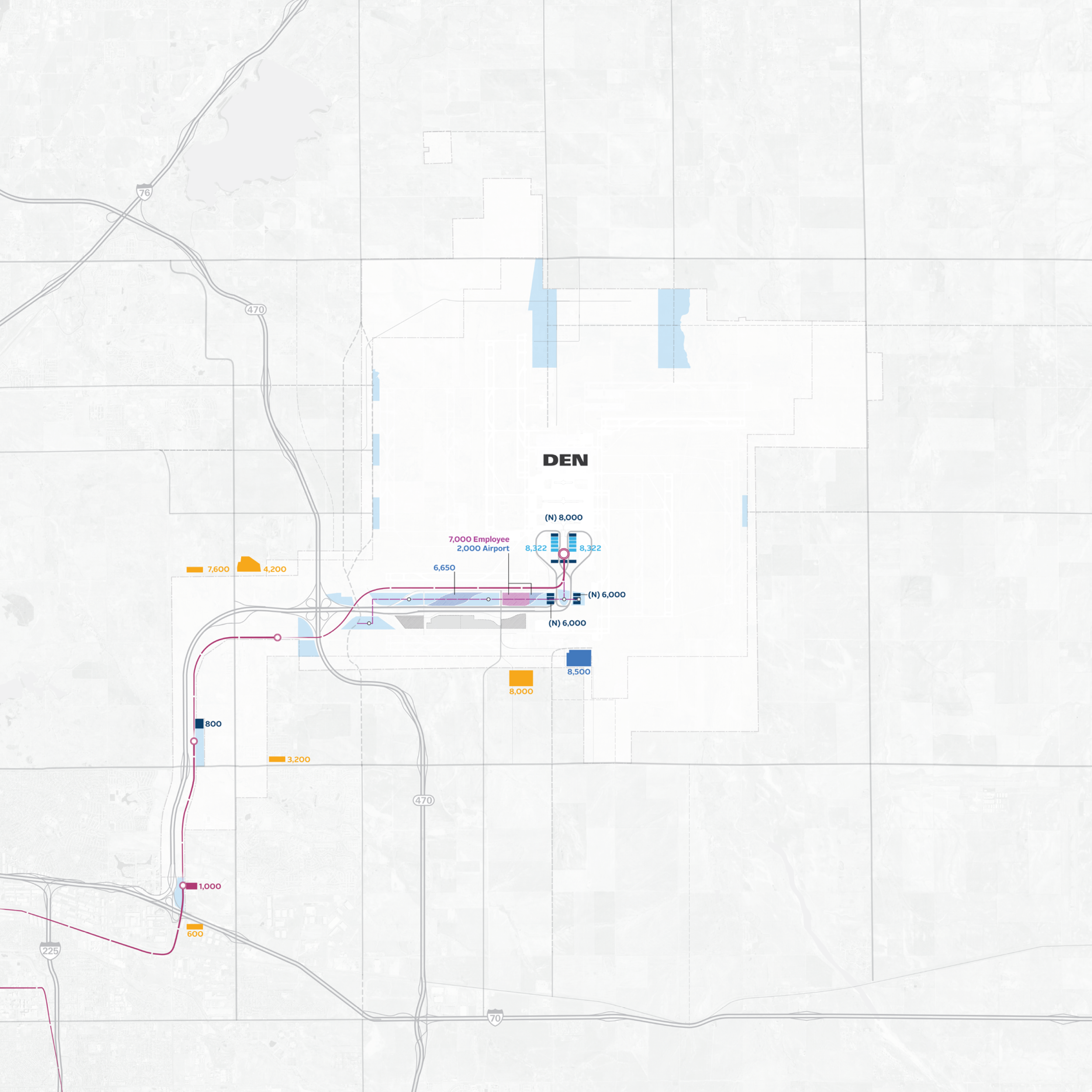
PARKING
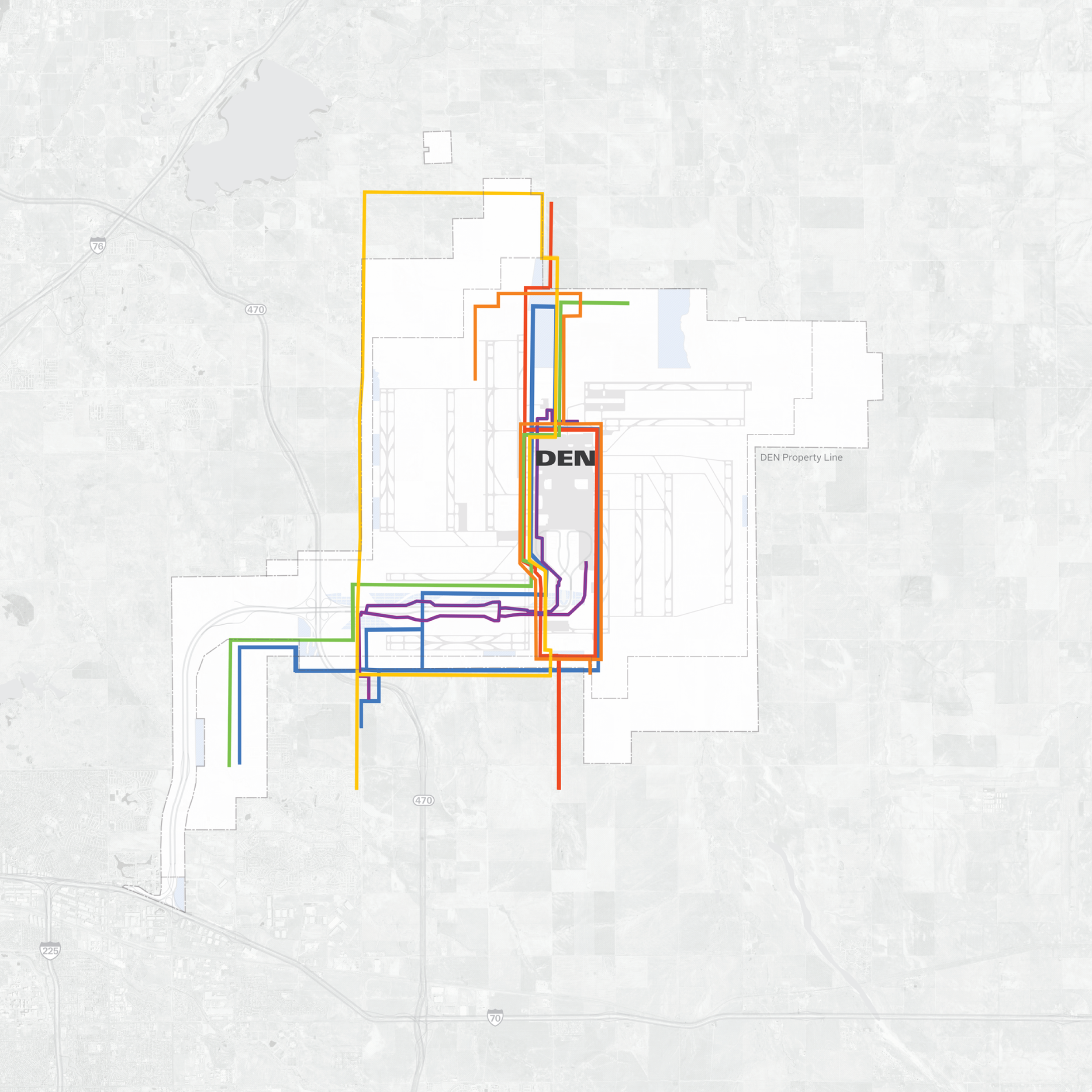
UTILITIES

VIEWPLANES
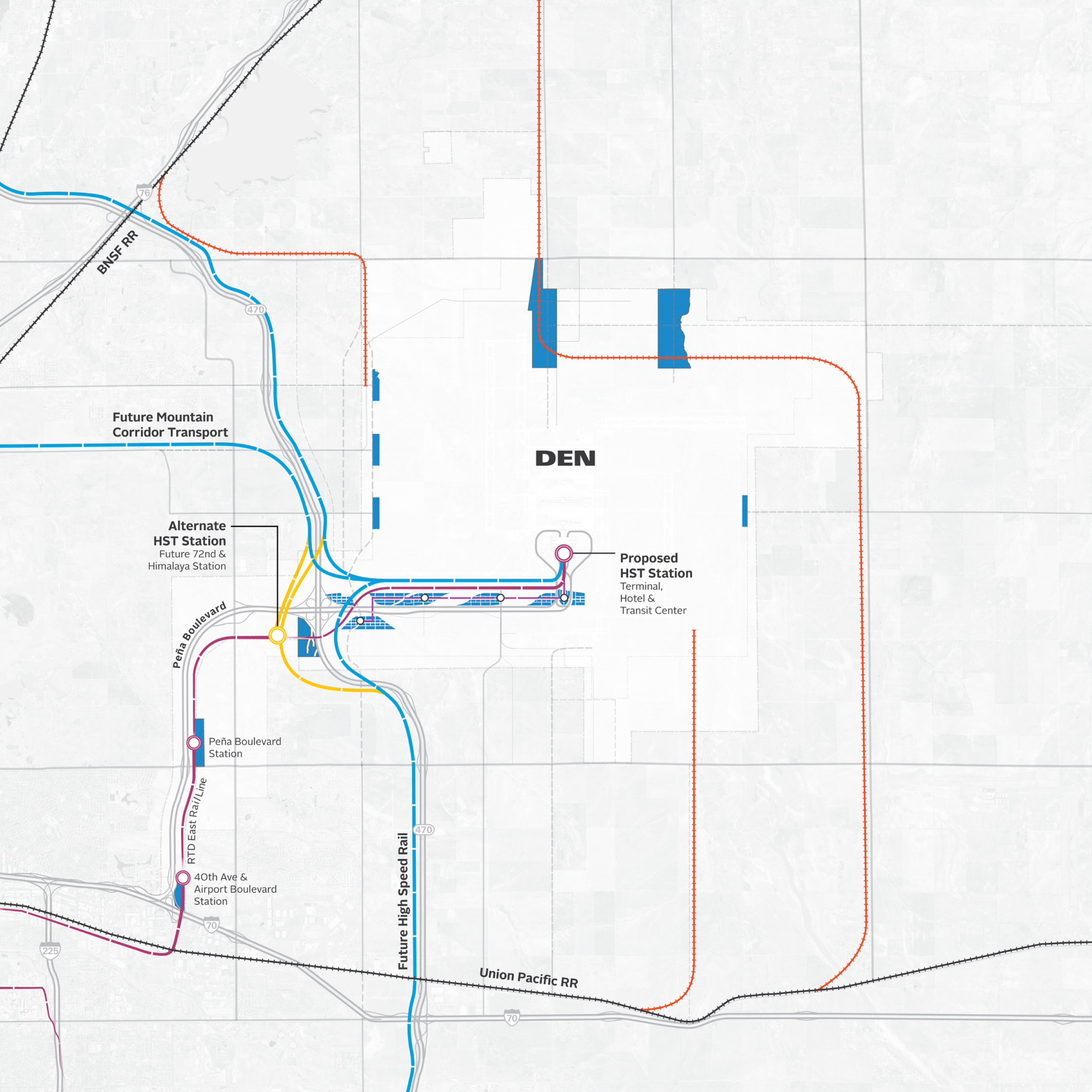
RTD + TRANSIT
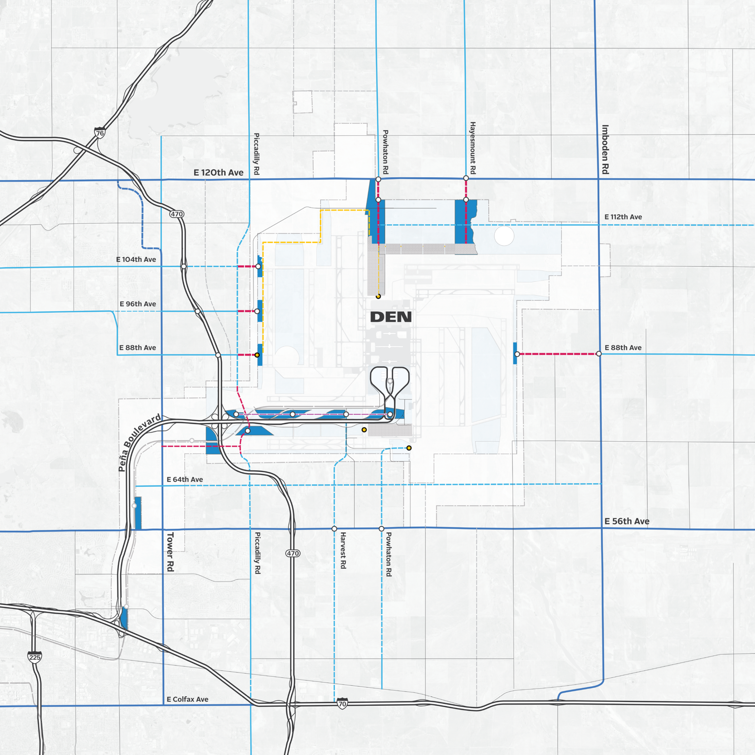
SITE ACCESS
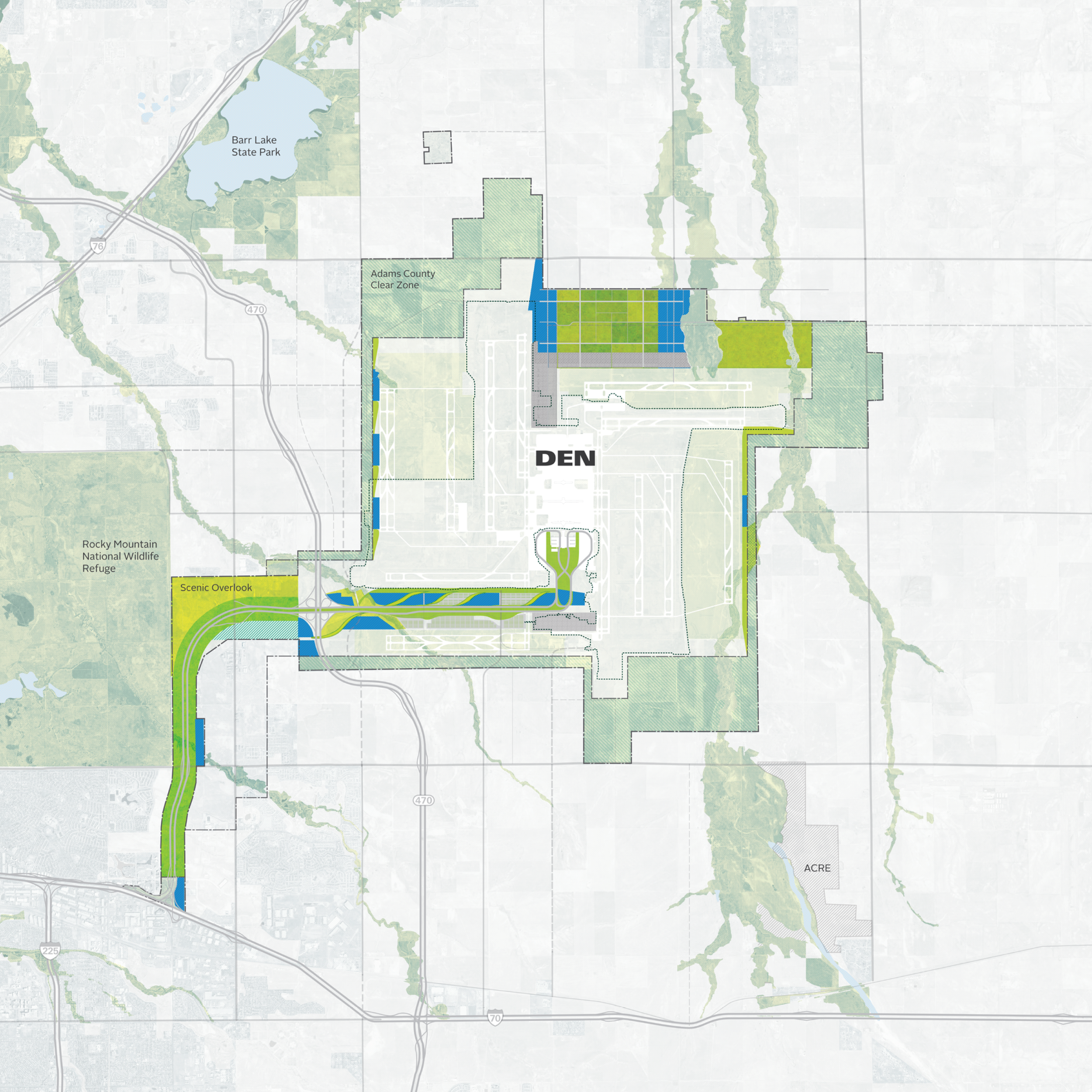
GREENSPACE + NODES OF DEVELOPMENT
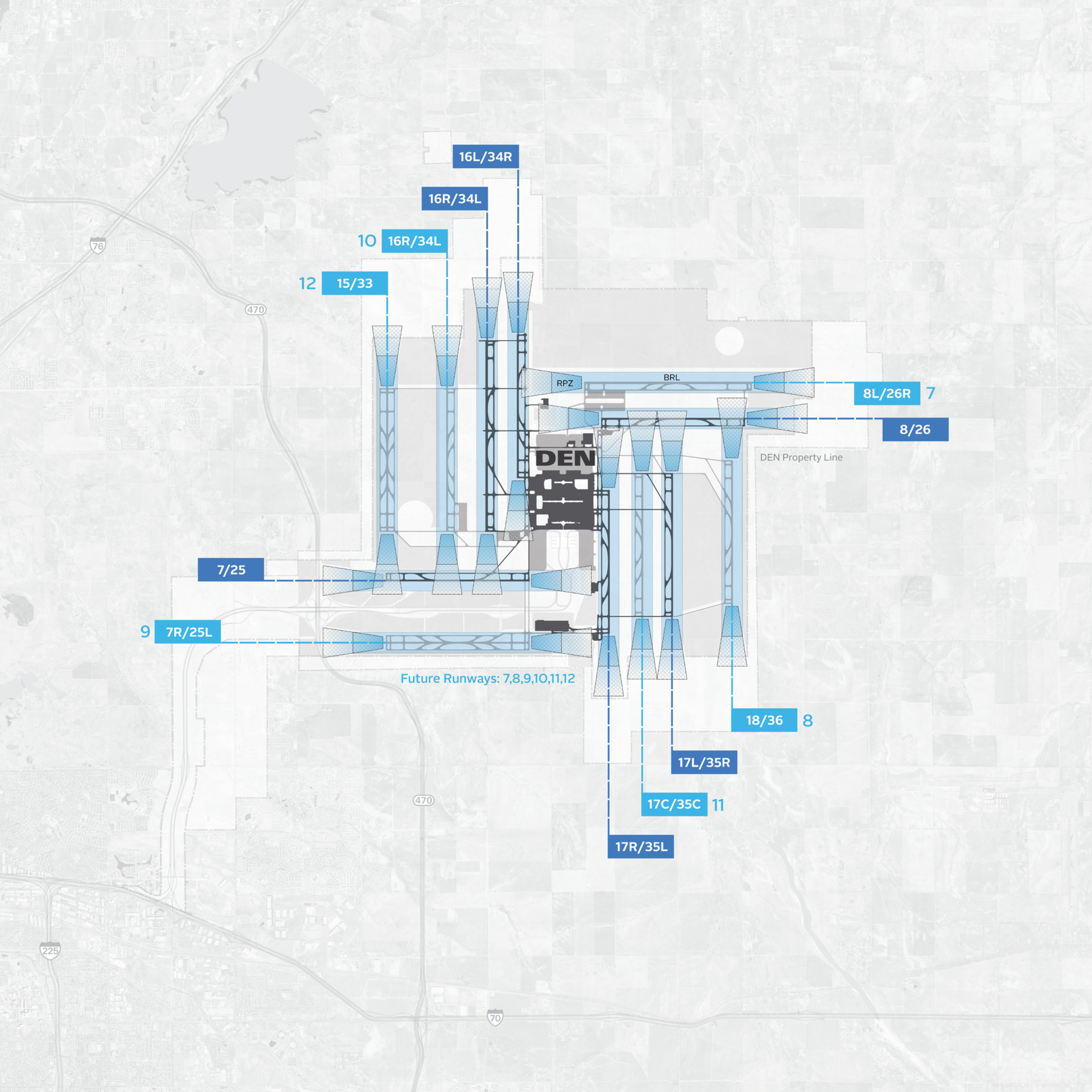
FUTURE RUNWAY EXPANSION
A Different Perspective
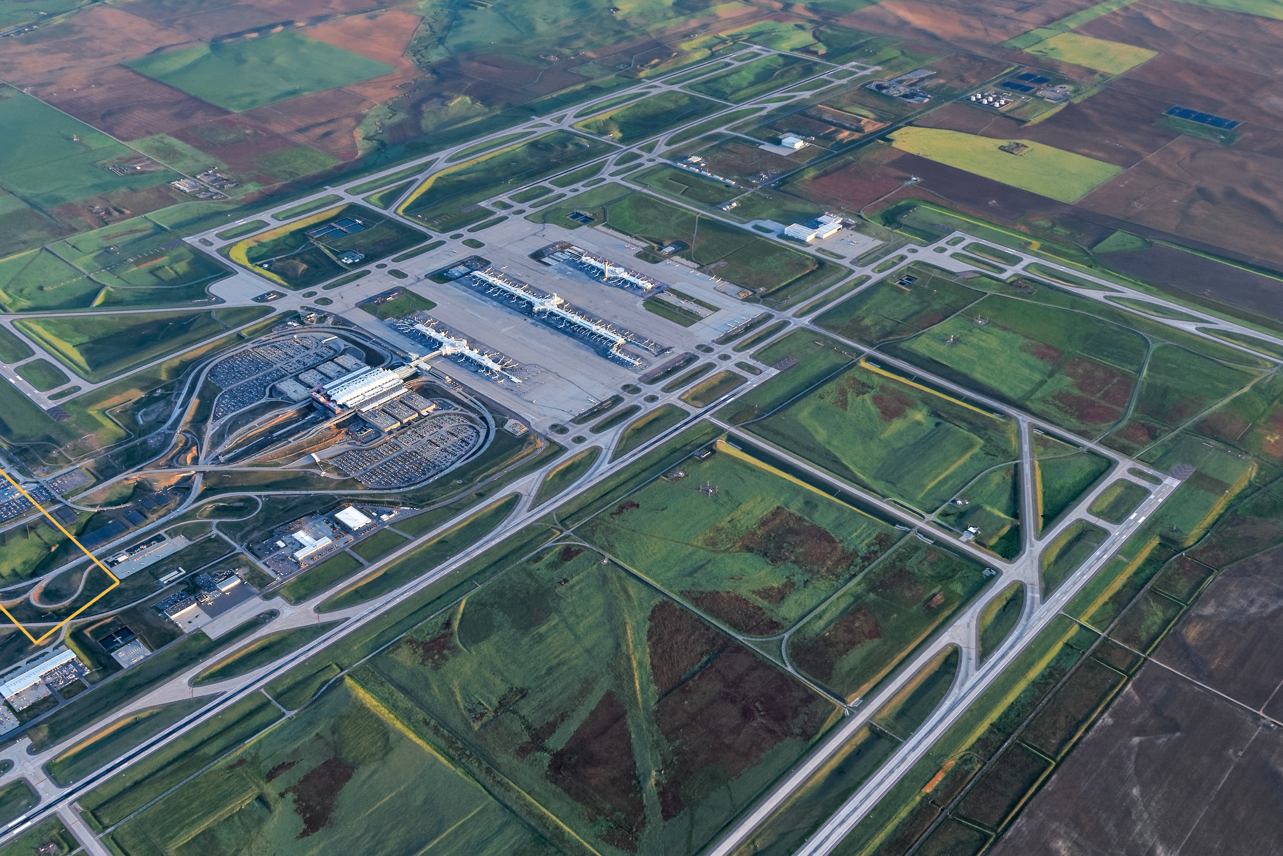
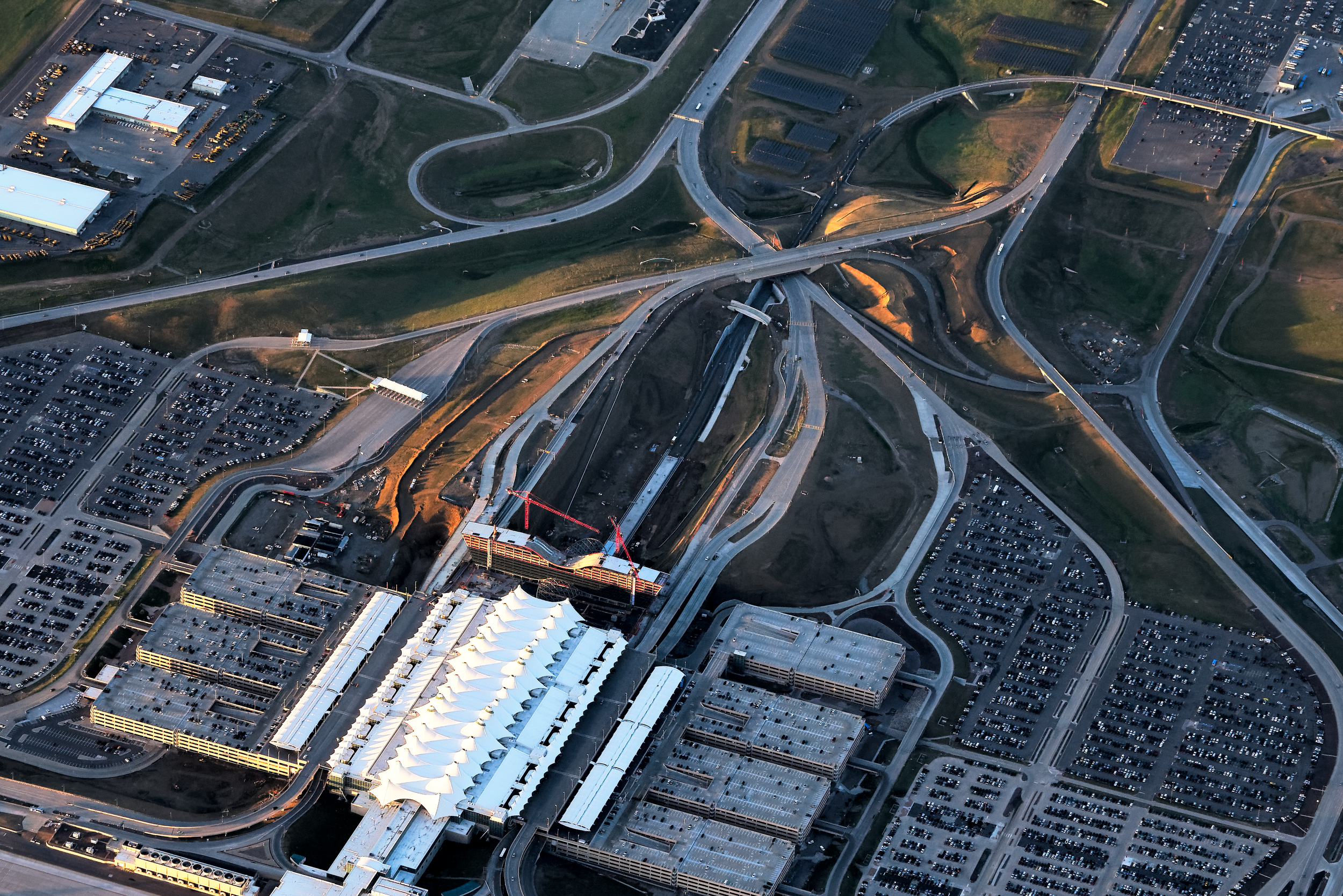
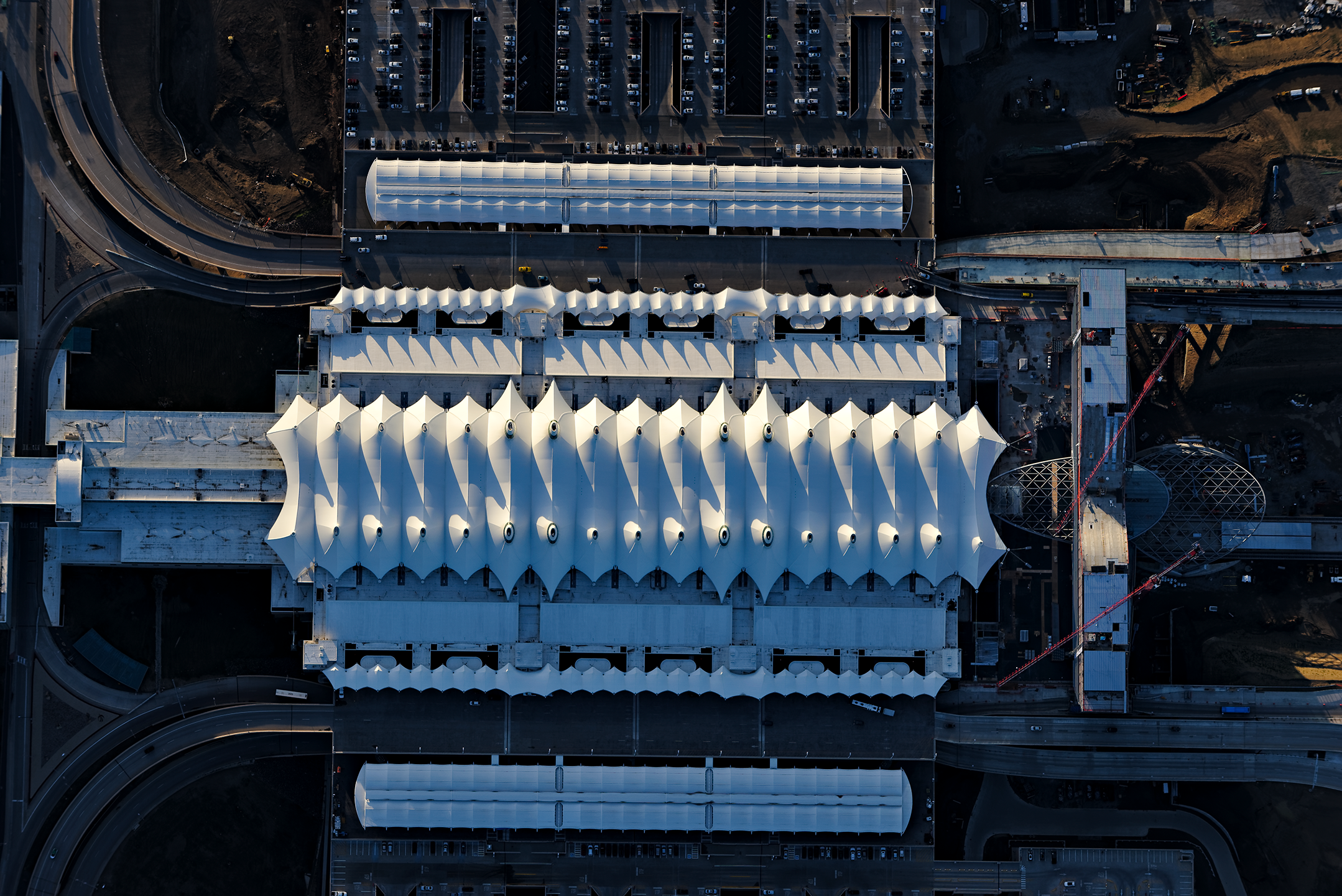
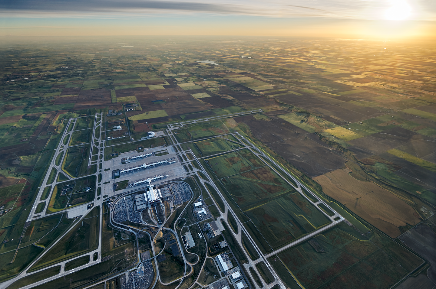
Captured by renowned aerial photographer Adriel Heisey, these stunning images offer a unique bird’s-eye perspective of the airport and its surrounding landscape. Piloting his one-man aircraft, Heisey skillfully documents the evolving region, showcasing the dynamic interplay between the airport's infrastructure and the vast, open terrain. These images were used as critical design tools, layered with projections of future development to visualize how the region’s growth may unfold. By integrating current conditions with future plans, the photos provide a powerful illustration of how the airport and its surroundings will evolve, offering a glimpse into the potential transformation of the landscape.
IMAGES ARE PROPERTY OF TRYBA ARCHITECTS AND PHOTOGRAPHER ADRIEL HEISEYDEN - SUNRISE
DEN - TERMINALS + RUNWAYS
DEN- WESTIN HOTEL + RTD
DEN - TERMINAL
DEN - FUTURE DEVELOPMENT
DEN - VISION 2065


